About the symposium
Spatial and temporal thinking is important not just because everything happens at some places and at some time, but because knowing where and when things are happening is key to understanding how and why they happened or will happen. Spatial data science is concerned with the representation, modeling, and simulation of spatial processes, as well as with the publication, retrieval, reuse, integration, and analysis of such space- and place-centric data. It generalizes and unifies research from fields such as geographic information science/geoinformatics, geo/spatial statistics, remote sensing, environmental studies, and transportation studies, and fosters applications of methods developed in these fields in other disciplines ranging from social to biological and physical sciences.
Data-driven methods, such as machine learning models, have been attracting attention from the Geoscience community for the past several years. For instance, they have been successfully used to quantify the semantics of place types, to classify geo-tagged images, to predict traffic and air quality, to improve resolution of remotely sensed images, to recognize objects in such imagery, to predict and compare trajectories, to name but a few. Geospatial observations may be vague, uncertain, heterogeneous, dependent on other nearby observations, biased, and multimodal; thus, spatial and temporal principles should be included in data science techniques such as deep neural networks. Unsurprisingly, research has shown that by doing so, we can substantially outcompete more general (non-spatial) models when applied to geo-data or applications with a spatial and temporal component.
To keep this discussion alive and help the community to exchange ideas and lessons learned about spatial and temporal aspects of data science, we are hosting the 6th Spatial Data Science Symposium (SDSS 2025) as a distributed virtual meeting. The symposium aims to bring together researchers from both academia and industry to discuss experiences, insights, methodologies, and applications, taking spatial and temporal knowledge into account while addressing their domain-specific problems. The format of this symposium will be a combination of keynotes, scientific sessions, as well as paper presentations. In contrast to classical conferences, the community will decide on those sessions, and the main focus will be on interaction. Hence, we welcome submissions for both papers and sessions (see below). SDSS 2025 will be a distributed symposium in a sense that while the event as such will be online, we will host (and help others to host) individual get-togethers to jointly experience the symposium in person.
DATES
Paper submission deadline: September 26 October 3, 2025
Session submission deadline: September 12 September 19, 2025
Session notification: September 19 September 26, 2025
Paper notification: October 31 November 7, 2025
Symposium Dates: December 4-5, 2025
Register
Registration is free but there are limited spaces.
You are invited to register for both days of the symposium or just one. Click the links below to register via Zoom.
If you do not already have an account with zoom, you will be asked to create one in order to register.
Register for Day 2
Keynote Speakers
This year we are happy to welcome two keynote speakers (one TBA) who are working on the cutting edge of spatial data science.

Tuuli Toivonen
Professor, University of Helsinki & Director, Digital Geography LabTuuli Toivonen is a geographer and professor of geoinformatics at the University of Helsinki, where she leads the interdisciplinary Digital Geography Lab. Her research focuses on understanding the dynamics of people and places—and their interactions—in both urban and natural environments, using accessibility and mobility as key perspectives. An important part of her work involves developing approaches that leverage open and big data, spatial analytics, and machine learning. In addition to applied geoinformatics, her research contributes to urban geography, land-use and transport planning, sustainability science, and conservation geography.

David O'Sullivan
Honorary Professor, University of AucklandDavid is an Honorary Professor in the School of Environment at University of Auckland. He previously held positions at Victoria University of Wellington, UC Berkeley, Auckland, and Penn State. David gained his PhD in Architecture and Urban Planning at University College London in 2000, focusing on dynamic simulation models of urban neighbourhood change. David's research interests focus on the spatial and computational methods needed to develop our understanding of the complex, dynamic, and deeply interconnected world we live in. He has worked on various topics, from accessibility, gentrification, and ethnic and racial segregation, to the geography of personal names, and the spatial dynamics of disease and invasive pests. David has published extensively on these and other topics. He has written books on geographic information analysis, spatial simulation, and computing geographically, and has expertise in a wide range of methods across each of these areas.
Live Interview
The symposium will feature a live/on-stage, interactive interview with Michael Goodchild from UC Santa Barbara.

Michael Goodchild
Emeritus Professor of GeographyUniversity of California
Michael F. Goodchild is Professor Emeritus of Geography at the University of California, Santa Barbara. Until 2012 he held the Jack and Laura Dangermond Chair of Geography and was Director of UCSB’s Center for Spatial Studies. He received his BA degree from Cambridge University in Physics in 1965 and his PhD in Geography from McMaster University in 1969. His research and teaching interests focus on issues in geographic information science, including uncertainty in geographic information, discrete global grids, and volunteered geographic in-formation. He has directed or co-directed several large funded projects, including the National Center for Geographic Information and Analysis, the Alexandria Digital Library, and the Center for Spatially Integrated Social Science. He was elected member of the US National Academy of Sciences in 2002, and Foreign Member of the Royal Society and Corresponding Fellow of the British Academy in 2010; and in 2007 he received the Prix Vautrin Lud. He has published over 550 books and articles. He moved to Seattle upon retirement in 2012, and currently holds part-time positions as Research Professor at Arizona State University and as Distinguished Chair Professor at Hong Kong Polytechnic University.
Accepted Papers
This year 8 papers were accepted for presentation and publication in the SDSS 2025 proceedings.
Paper Presentation Session I
- Simulating stress in urban active mobility: A multimodal framework integrating physiological and mobile eye tracking data in cycling (Martin Moser and Merve Keskin)
- Mobility vs. Contiguity: Spatially Explicit Graph Neural Networks for COVID-19 Forecasting (Fengjiao Li, Meiliu Wu and Anahid Basiri)
- Towards Climate-Resilient Cities: Digital Twins and Nature-based Solutions for Urban Heat Mitigation Planning (Gijs Van den Dool, Deepali Bidwai, Dania Kodeih, Mireille Elhajj and Van den Dool)
- A vision for participatory models of animal movement: a case study with Moose (Jugal Patel and Niiyokamigaabaw Deondre Smiles)
- PlaceAgents: Multi-Stop Pedestrian Itineraries as Platial Flows on Urban Networks (James Williams)
- Using spatial data to identify food accessibility in Lusaka, Zambia (Jordan Blekking, Kurt Waldman, Lisa-Marie Hemerijckx and Mboyonga Kaputula)
Paper Presentation Session 2
- Towards Automated Monitoring of Woody Plant Encroachment on Floodplains: A Remote Sensing and Hydrology Framework (Abdullah Toqeer, Andrew Hall, Ana Horta and Skye Wassens)
- ST-SplitVFL: Spatio-Temporal Split Vertical Federated Learning (Anita Graser, Jose Antonio Lorencio-Abril, Axel Weissenfeld and Anahid Wachsenegger)
Emerging Researcher Panel
This year's symposium will feature an Emerging Researcher Panel highlighting diverse voices from across the spatial data science community. Panelists at different career stages and from a range of disciplinary backgrounds will share their experiences, insights, and lessons learned as they navigated their own research paths. The session is designed to support new and early-career researchers by offering practical advice, candid reflections, and perspectives on building a meaningful and impactful career in spatial data science.
When is this session?

Milad Malekzadeh (Postdoctoral Researcher & Moderator)
University of Helsinki
Justine Blanford (Professor)
University of Twente
Faith Njoki Karanja (Associate Professor)
University of Nairobi
Hyesop Shin (Assistant Professor)
University of Auckland
Colin Robertson (Lead Data Scientist)
Boeing VancouverThematic Sessions
Along with regular paper presentations, this year's symposium will feature a series of thematic sessions organized by a variety of teams from around the globe. The session titles and organizers are listed below. More details will be added as they become available.
Generative AI and Agentic AI for GIS and Cartography
The session will explore the convergence of the latest exploration of Generative AI and Agentic AI in GIScience and Cartography, highlighting their transformative potential for geospatial data retrieval, analysis, and decision support. Generative AI, contributes powerful capabilities for creating synthetic spatial data, generating maps, coding, and simulating scenarios, offering new ways to support cartography and spatial data retrieval. Agentic AI, on the other hand, represents a major advance with its capacity for task planning, execution, adaptability, and goal-oriented autonomy in dynamic environments. By combining agentic coordination with generative and adaptive reasoning, these methods enable richer spatial representations, enhanced spatial decision-making, and more intelligent GIS workflows.
When is this session?

Song Gao
University of Wisconsin-Madison
Ying Nie
University of Wisconsin-Madison
Zhenlong Li
Pennsylvania State University
Huan Ning
Emory University
Yuhao Kang
University of Texas at Austin
Jinmeng Rao
Google DeepMindBuilding the Future of Open Mobility Data: Towards a Collaborative MobilityBank Platform
This session will examine the vision for a global, open, and privacy-preserving platform for GPS tracking studies, drawing on the recently proposed MobilityBank initiative (formerly OpenGPS). It will begin with two short presentations: one outlining the current landscape of mobility datasets, their limitations, and gaps, and another introducing the conceptual framework for MobilityBank as a centralized repository. Participants will then take part in breakout discussions to consider the design of such a platform, the technical, ethical, and institutional challenges it raises, questions of governance, and possible incentives for researcher participation. The session will conclude with a collective mapping of ideas and priorities to inform the next steps for MobilityBank.
When is this session?

Milad Malekzadeh
University of Helsinki
Jed A. Long
Western University
Katarzyna Sila-Nowicka
University of Auckland
Vanessa Brum-Bastos
University of Canterbury
Henrikki Tenkanen
University of AaltoTrustworthy (Geo)AI for Population Health
This Presentation Series will highlight cutting-edge GeoAI approaches in public health, focusing on multimodal, spatially explicit methods (e.g., imagery, mobility trajectories, surveys, and health data) that move from prediction to decision support. It will showcase advances in AI and vision–language models for geospatial health (e.g., exposure assessment, environmental epidemiology, mental/behavioural health), with attention to links between methodological innovation and population outcomes such as health equity and disease burden reduction. The series will also address robustness, fairness, and privacy-preserving techniques in real-world deployments, explore causal inference and counterfactual analysis to connect GeoAI outputs with public-health interventions, and share reproducible pipelines and standards for translating analytics into policy and practice.
When is this session?

Meiliu Wu
University of Glasgow
Yanjia Cao
University of Hong Kong
Yuchen Li
University of Leeds
Calvin Tribby
City of Hope
Ismaïl Saadi
University of CambridgeGeoAI – Reflections on uncertainty and bias
Uncertainty and bias in GeoAI are central concerns for the GIScience community. This session brings together conceptual and applied perspectives, examining how large language models construct and reproduce geographic knowledge, often privileging certain regions or misrepresenting local contexts. Building on recent evaluations of tasks like geocoding and elevation estimation, we raise critical questions about treating LLMs as geographic knowledge generators and strategies for mitigating bias. Complementing this, research on uncertainty highlights diverse domains—such as wildfire risk, cattle movement, energy modeling, and supply-chain prediction—illustrating how measurement errors, sensor noise, algorithmic limitations, and incomplete knowledge shape outcomes. By distinguishing between aleatoric and epistemic uncertainty and discussing mitigation strategies like probabilistic modeling, ensemble learning, and uncertainty mapping, the session invites an interactive dialogue to shape a shared research agenda on equitable and trustworthy GeoAI.
When is this session?

Johannes Scholz
University of Salzburg
Omid Reza Abbasi
University of Salzburg
Franz Welscher
University of Salzburg
Thomas Schneidergrube
University of Salzburg
Florian Kienhöfer
University of Salzburg
Merve Keskin
University of SalzburgLocation Privacy in the Digital Society
As digital mapping and location-based services become integral to daily life, the issue of location privacy grows increasingly critical. This panel session will build upon the momentum from last year and continue exploring the intersection of privacy, technology, and geography, focusing on the ethical and technological challenges associated with geospatial data collection and usage. Participants will gain insights from experts on public perceptions of location privacy and innovative solutions on privacy protections.
When is this session?

Hongyu Zhang
University of Massachusetts Amherst
Yue Lin
University of IllinoisUrbana-Champaign
Junghwan Kim
Virginia Tech
Pankajeshwara Sharma
University of FijiUrban Morphology with Python: City Structure as a Predictor and a Target
This tutorial introduces urban morphometrics as a way to capture and analyze the built-up structure of cities, offering insights into their function, population, and development. Focusing on building footprints and street networks, it presents the momepy toolkit within the PySAL ecosystem, alongside GeoPandas and networkX, to demonstrate how spatial units can be generated and used to measure aspects of urban form such as size, shape, distribution, and configuration. These metrics will then be applied in two ways: to explain urban phenomena through spatial regression, and to detect distinct spatial patterns and hierarchies using classification models. Attendees will be able to code along on their machines or in-browser with Google Colab, and while only basic Python knowledge is expected, the principles introduced will be broadly transferable to other contexts.
When is this session?

Martin Fleischmann
Charles University
James D. Gaboardi
Oak Ridge National LaboratoryGeoAI and Spatial Data Science for Disaster Research
Natural disasters, such as wildfires, structural fires, hurricanes, winter storms, floods, and earthquakes, pose significant threats to people and society. With climate change, these disasters are likely to become even more frequent and more costly in the near future. The availability of various geospatial data (e.g., satellite images, weather and climate data, mobile phone location data, historical disaster data, census data) combined with geospatial artificial intelligence methods provide great opportunities for understanding human-environment interactions under these disaster contexts. This session aims to bring together researchers interested in using GeoAI and spatial data science to answer disaster-related research questions and address issues in any aspect of disaster management, from mitigation and preparedness to response and recovery. Given the devastating impacts of recent wildfires and urban fire incidents, this session will also feature research on modeling fire risks and planning the spatial layout of fire services from a geospatial perspective.
When is this session?

Huanfa Chen
University College London
Jing Yao
University of Glasgow
Kai Sun
Chinese University of Hong Kong
Bing Zhou
University of Tennessee, Knoxville
Jiyeon Kim
University at Buffalo
Yingjie Hu
University at BuffaloDetecting and Evaluating AI Misalignment in Geographic Contexts
The problem of AI alignment concerns ensuring AI behaves in line with human values and goals. In geography, misaligned AI can distort spatial data, misguide urban planning, or reinforce mapping biases, with harmful consequences for communities and environments. This session offers a tutorial on detecting and evaluating AI misalignment in geographic contexts, focusing on (1) measuring geographic bias in AI performance, (2) the limited geographic diversity of large language models (LLMs), and (3) the misalignment of LLMs in delineating vague cognitive regions. We will demonstrate three projects: GeoBS, a Python toolbox for evaluating geographic bias; Prototype Explorer, an information observatory for analyzing geographic diversity and prototypes; and case studies on how LLMs define vague regions such as the Alps across scales and languages. Each co-organizer will lead a 15-minute sub-session, with 5 minutes reserved for Q&A.
When is this session?

Zilong Liu
University of Vienna
Mina Karimi
University of Vienna
Zhangyu Wang
University of MainemGeoHealth: real-world applications of spatial data science to improve population health and wellbeing.
This themetic session invites submissions in the area of mGeoHealth (Campbell et al., 2021; Campbell & Marek, 2022), which sits at the intersection of mobile health (mHealth) and GeoHealth (Health and Medical Geography) and often draws on spatial data science methods combined with mobile phone location data. The session will provide a forum for spatial data science researchers to consider applications in health and wellbeing, while also engaging health-focused scholars with quantitative spatial approaches. We particularly welcome submissions on social and physical environmental interactions with health outcomes (e.g., social connections, greenspace, mental health, happiness). We aim to attract 4–5 papers, with the possibility of lightning talks if submissions are high, and plan to propose a special issue on mGeoHealth in a journal such as Health & Place. Our goal is to strengthen engagement between spatial data science and health geography, advancing geographic data science for public good.
When is this session?

Malcolm Campbell
University of Canterbury
Lukáš Marek
University of Canterbury
Phoebe Eggleton
University of CanterburyVanessa Brum-Bastos
University of CanterburyProgram
Primary times are viewed in EST
-
Opening
-
Break
-
TS: GeoAI and Spatial Data Science for Disaster Research
-
Break
-
Lunch / Dinner / Breakfast
-
Break
-
TS: Building the Future of Open Mobility Data: Towards a Collaborative MobilityBank Platform
-
Break
-
TS: Generative AI and Agentic AI for GIS and Cartography
-
Break
-
TS: mGeoHealth: real-world applications of spatial data science to improve population health and wellbeing
-
Break
-
TS: GeoAI – Reflections on uncertainty and bias
-
Break
-
TS: Urban Morphology with Python: City Structure as a Predictor and a Target
-
Break
-
TS: Trustworthy (Geo) AI for Population Health
-
Lunch / Dinner / Breakfast
-
Emerging Researcher Panel
-
Break
-
Break
-
TS: Detecting and Evaluating AI Misalignment in Geographic Contexts
-
Break
-
TS: Location Privacy in the Digital Society
-
Closing
Organizing Committee

Vanessa
Brum-Bastos
Program Chair
University of Canterbury

Yingjie
Hu
Program Chair
University at Buffalo

Ivan
Majic
Program Chair
Graz University of Technology

Grant
McKenzie
Program Chair
McGill University

Marcela
Suarez
Program Chair
University of New Mexico

Krzysztof Janowicz
General ChairUniversity of Vienna
Program Committee
- Clio Andris, Georgia Tech
- Fernando Benitez-Paez, University of St Andrews
- Filip Biljecki, National University of Singapore
- Yanjia Cao, University of Hong Kong
- Victoria Fast, University of Calgary
- Vanessa Frias-Martinez, University of Maryland
- Song Gao, University of Wisconsin-Madison
- Anita Graser, Austrian Institute of Technology
- Steffen Knoblauch, University of Heidelberg
- Myeong Lee, George Mason University
- Jed Long, Western University
- Francisco Rowe, University of Liverpool
- Johannes Scholz, Paris-Lodron-University Salzburg
- Katarzyna Sila-Nowicka, University of Auckland
- Esra Suel, University of Zurich
- Judith Verstegen, Utrecht University
- Blake Walker, University of Erlangen-Nuremberg
- Manzhu Yu, Penn State University
- Hongyu Zhang, University of Massachusetts Amherst
Symposium Hubs
SDSS 2025 is an online and distributed symposium. This means that participants are encouraged to join one of the symposium hubs distributed around the world. Groups of participants will meet at these hubs to present and discuss with other participants both in person and online. Joining a hub is not necessary, but encouraged.
To join a hub, email the contact listed for the city.
If you are interested in hosting a hub in your city, please complete this form.

Vienna, Austria
University of ViennaContact: krzysztof.janowicz@univie.ac.at

Montreal, Canada
McGill UniversityContact: grant.mckenzie@mcgill.ca

Buffalo, USA
University at BuffaloContact:
yhu42@buffalo.edu

Christchurch, New Zealand
University of CanterburyContact: vanessa.bastos@canterbury.ac.nz
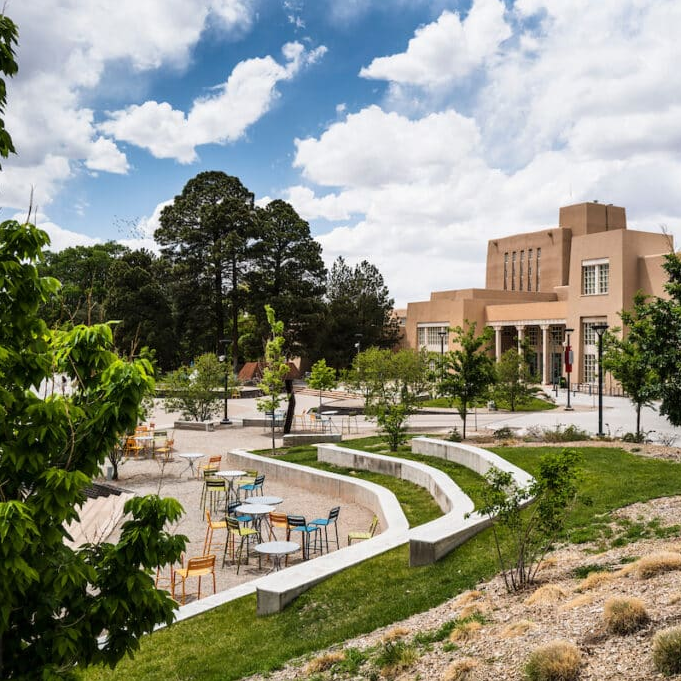
Albuquerque,
USA
University of New MexicoMore info here
Start delayed to 10am local
Contact:
marcelasuarez@unm.edu

Calgary, Canada
University of CalgaryContact: victoria.fast@ucalgary.ca

Nanjing, China
Nanjing Normal UniversityContact:
yexiang@nnu.edu.cn

Heidlburg, Germany
University of HeidelbergContact:
steffen.knoblauch@uni-heidelberg.de